Loch Fyne: Scotland's Longest Sea Loch, Top to Bottom
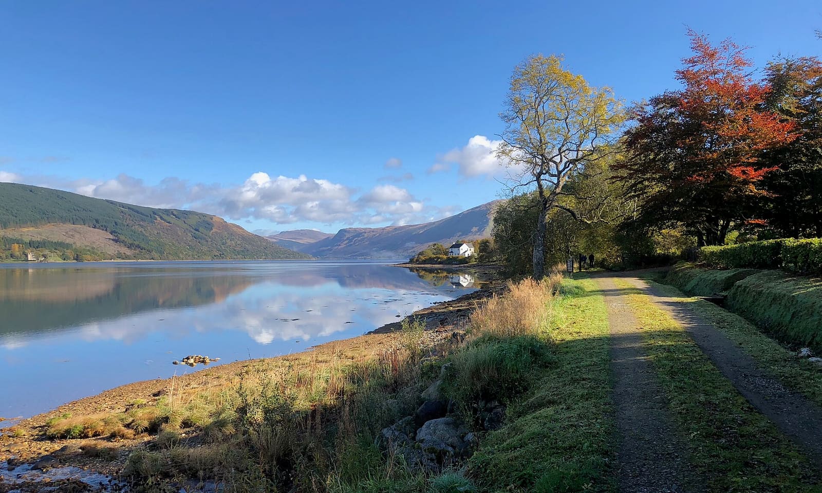
Loch Fyne is the longest sea loch in Scotland, reaching 65 kilometres inland from the Sound of Bute. That length is the whole point for a diver. You get sea water and sea life a long way from open coast, with the Arrochar Alps standing over the far end of it.
Wave heights here sit at 0.2 to 0.4 metres year round. On the west coast of Scotland, that is a rare thing.
Add otters, seals, dolphins and summer basking sharks, plus a marine protected area covering the entire upper loch, and you have a place worth building a weekend around. The name means "Loch of the Vine", though nobody has found evidence that grapes grew here.
Where divers go
Loch Fyne is a long-established sport diving area, and two names come up again and again.
- St Catherines, where a boulder field runs off the coast alongside a wrecked speedboat
- Kenmore Point, where Stallion Rock rises alone from the seabed
Two very different things, then. A tumble of boulders with a small wreck sitting in it, and a single rock pinnacle standing up out of open bottom. If you have ever dived a Scottish sea loch you know how much life a structure like that can hold when the surrounding seabed is soft and featureless.
St Catherines is also the viewpoint in the classic photograph of the loch, looking across to Dunderave Castle on the far shore. Worth five minutes on the surface before you kit up.
The loch, shore by shore
Loch Fyne sits on the coast of the Cowal Peninsula, in Argyll and Bute. The northern end is mountain country: Beinn Bhuidhe, Glen Shira, Glen Fyne, Glen Croe, with Arrochar, Tyndrum and Loch Lomond all close by.
The A83 runs round the head of the loch and then down the west side, from Ardrishaig to Tarbert along the Knapdale coast. For the east shore you leave the A83 north of Cairndow and take the A815 down through Strachur, then the A886 to Newton, then the B8000 south to Millhouse. From there you can reach Portavadie or Kames.
Driving from one shore to the other the long way round takes a while. There is a shortcut: a vehicle ferry crosses the mouth of the loch between Portavadie on the Cowal side and Tarbert on Kintyre.
Boats have their own shortcut. The Crinan Canal links Loch Fyne at Ardrishaig with the Sound of Jura at Crinan, saving small vessels the trip around the Kintyre Peninsula. It was built between 1794 and 1801 under John Rennie, redesigned in parts by Thomas Telford in 1816 after water supply problems, and has fifteen locks over nine miles.
Seasons and sea temperature
August is the warmest month in the water at around 15 degrees, with July just behind and September barely cooler. February is the cold end at 8 degrees. Summer is also when basking sharks can turn up in the loch, so late season lines up nicely with both the temperature and the wildlife.
| Month | Sea temperature (°C) | Wave height (m) |
|---|---|---|
| January | 9 | 0.4 |
| February | 8 | 0.3 |
| March | 8 | 0.4 |
| April | 9 | 0.3 |
| May | 12 | 0.2 |
| June | 14 | 0.2 |
| July | 15 | 0.2 |
| August | 15 | 0.2 |
| September | 15 | 0.3 |
| October | 14 | 0.3 |
| November | 13 | 0.3 |
| December | 11 | 0.3 |
Those marine figures show how flat the loch stays. The wave height never climbs above 0.4 metres in any month of the year, and the calmest stretch runs from May through August at 0.2.
What lives here
Dolphins, seals and otters all inhabit Loch Fyne. Basking sharks can appear in the summer months. Birders still talk about the Ross's gull that showed up in early 2007.
In 2014 the loch was declared a Nature Conservation Marine Protected Area. The designation covers the entire loch northwards from a point near Otter Ferry.
The loch's older fame is edible. Loch Fyne has a long reputation for its oysters, which gave their name to Loch Fyne Oysters and the restaurants that followed, and for herring, which gave the world the Loch Fyne Kipper. In the mid-19th century this was the battleground between the traditional drift-net men and the trawl-net crews who appeared around Tarbert and Campbeltown in 1833.
Above the water
The shores of Loch Fyne are stacked with castles: Inveraray, Dunderave, Kilmory, Minard, and the ruins of Castle MacEwen and Old Castle Lachlan. Inveraray Bell Tower rises 126 feet and can be seen from much of the loch.
Crarae Garden, run by the National Trust for Scotland, sits ten miles south of Inveraray and looks out over the water. Above the loch stands the Tinkers' Heart, an old travellers' monument where weddings traditionally took place.
There is wartime history here too. During the Second World War the shore establishment HMS Quebec, the No 1 Combined Operations Training Centre, operated from the shores a few miles south of Inveraray. It taught landing craft work and beachhead operations to Royal Navy, RAF and Army personnel, plus Allied troops. Around 250,000 people passed through by 1944. The main site is now Argyll Caravan Park.
Planning it
Work out your driving first, because the loch is 40 miles long and crossing it by road takes real time. The A83 handles the head of the loch and the west side; the A815, A886 and B8000 chain together down the east shore. If you want to work both sides, the Portavadie to Tarbert ferry saves the drive round the bottom.
Summer gives you the warmest water, the flattest surface and the chance of a basking shark. Winter here is still calm, just colder. The Wikipedia entry is a good starting point for the castles and canal if you want a surface day built in.
If you dive Loch Fyne, log it in Scubaspot: note the depth you found the speedboat at St Catherines, add a photo of Stallion Rock rising out of the bottom, and rate the sites so the next diver planning an Argyll weekend knows where to start. Head to scubaspot.co.