Dhilba Guuranda–Innes National Park: Wrecks, Cliffs and Sea Lions on Yorke Peninsula
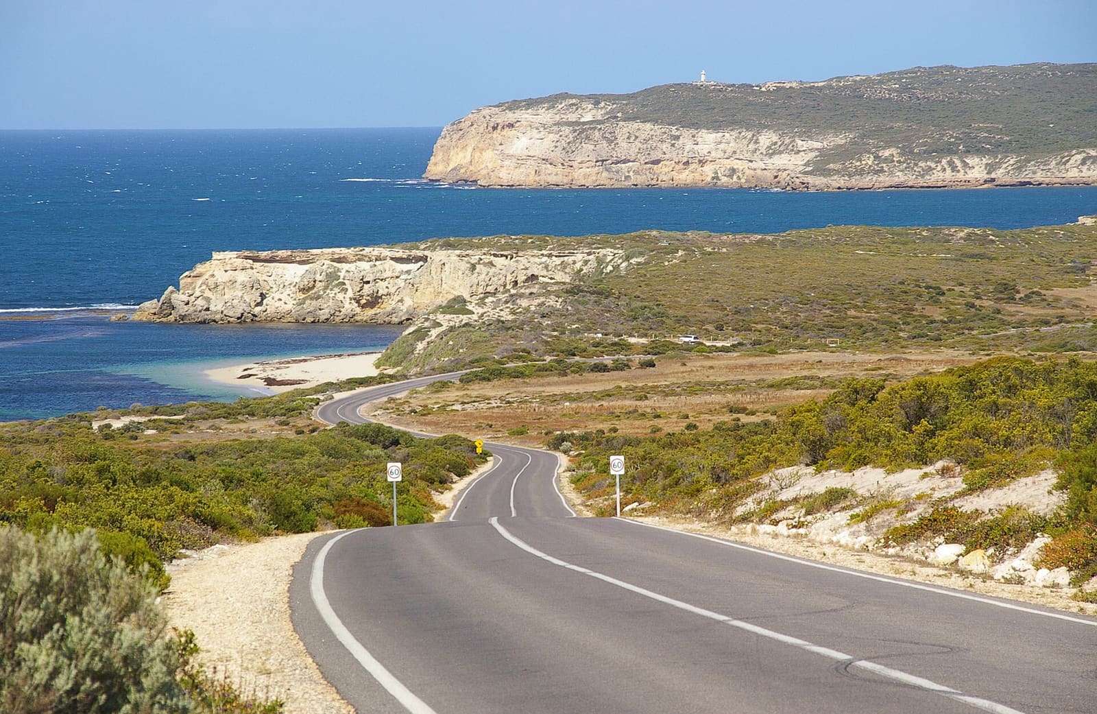
Drive to the far southwest tip of Yorke Peninsula and the road simply runs out at the sea. Cliffs on one side, dune country on the other, and somewhere below the surface at least four shipwrecks protected by law.
That is the appeal of Dhilba Guuranda–Innes National Park. It is a small park, 94.15 square kilometres, yet it packs sandy beaches, a rugged wreck-scattered coastline and a marine park habitat protection zone into distances you can cover in a day.
It is also South Australia's most visited park, about 300 kilometres from Adelaide, and it is known for camping, bushwalking, fishing, surfing and scuba diving all in the same few kilometres. If you like your diving with a long drive and a campfire at the end of it, this is your kind of place.
Four wrecks on one stretch of coast
Two of them share the same beach. The barque Ethel ran aground between West Cape and Cape Spencer in 1904 on what is now called Ethel Beach, and the SS Ferret followed her onto the same sand in 1920.
The Ethel lies parallel to the shore below the cliff. Her hull stayed largely intact for decades, worn down storm by storm, until a severe gale in 1988 collapsed it completely. What is left is the iron frame, mostly buried, sometimes uncovered again when the weather works the sand away.
The other two sit at either end of the park's eastern coast. The SS Marion grounded just east of Chinamans Hat Island in 1862. The Hougomont was scuttled in 1932 to form a breakwater and lies close to the coastline near Stenhouse Bay. All four are protected under the Underwater Cultural Heritage Act 2018 and the Historic Shipwrecks Act 1981, which the park's heritage listing sets out.
How the coast is laid out
From Willyama Bay to Cape Spencer you get bays and headlands: Cable Bay, Stenhouse Bay, the blunt profile of Rhino Head, and a line of cliffs between Cable Bay and Stenhouse Bay.
Between Cape Spencer and West Cape the cliffs run unbroken, between 37 and 79 metres high, with pockets of sandy beach at their feet. The cliff line drops lower from West Cape to Pondalowie Bay. From the south end of Pondalowie Bay up to Gym Beach it is dune country, broken only by Royston Head and the cliffs running east to Dolphin Beach.
Four islands sit just off the coast and belong to the park: Chinamans Hat Island, then Middle Island and South Island west of Pondalowie Bay, and Royston Island off Royston Head. Worth knowing before you plan anything around them: South and Middle Islands, Royston Island, and several coastal stretches are designated no access areas.
What lives here
The water belongs to pinnipeds and cetaceans. Australian sea lions and New Zealand fur seals are both recorded in the park, along with common dolphins, bottlenose dolphins and southern right whales.
Above water the list is just as good. Ospreys, peregrine falcons, white-bellied sea-eagles, hooded plovers, fairy terns and little penguins all turn up, and the park was declared in part to protect habitat for the malleefowl and the western whipbird. The walking trails exist partly so you can watch whales and dolphins from the cliff tops.
Three of the park's saline lakes, Deep Lake, Inneston Lake and Marion Lake, support stromatolites and are on the South Australian Heritage Register. Not diving, but worth the detour.
Sea temperature and swell
| Month | Sea temperature (°C) | Wave height (m) |
|---|---|---|
| January | 21 | 1.9 |
| February | 21 | 2.0 |
| March | 20 | 2.0 |
| April | 19 | 2.2 |
| May | 18 | 2.1 |
| June | 16 | 2.4 |
| July | 16 | 2.8 |
| August | 15 | 2.7 |
| September | 15 | 2.4 |
| October | 16 | 2.5 |
| November | 17 | 2.2 |
| December | 19 | 2.1 |
The pattern in the marine forecast data is clear enough: warmest water from January to March at around 20 to 21 degrees, coldest from July to September at 15 to 16, and the biggest average swell in July and August. Wikivoyage notes there is no single best time to visit, though winter wind can make the park genuinely cold.
Practical details
There is one entrance, next to Marion Bay. At the roundabout, turn left for the visitor centre on Stenhouse Bay Road at Inneston, open daily 10AM to 3PM, which handles campground bookings and maps. You cannot enter the park via Gym Beach no matter what your mapping app says; use the Gym Beach Rd turnoff from Marion Bay Rd instead.
A vehicle fee applies and is paid on the park website. As of June 2023 it was $12.50 per vehicle, $10 for concession holders, covering one day. Two- and twelve-month SA parks passes are valid here.
Camping grounds run east to west at Stenhouse Bay, Cable Bay, Pondalowie Bay, Casuarina, Shell Beach and Gym Beach. For a roof, there are restored gypsum-era buildings at Inneston, the Stenhouse Bay hall, and a cottage at Shell Beach. You can wander Stenhouse Bay and Inneston on foot, but everything else means driving, as the Wikivoyage guide spells out.
Planning it is mostly a question of booking: vehicle entry online, a campsite or an Inneston cottage, and a drive out from Adelaide or Port Wakefield along the Yorke Highway to Marion Bay.
If you make it down to Ethel Beach, log the dive and tell us whether the sand had given up the Ethel's iron frame that week, or buried it again. Add your sea lion shots, rate the Hougomont, and pin your campsite for the next person planning the drive at Scubaspot.