Poor Knights Islands: Arches, Caves and Kelp Off Northland
Picture a cavern the size of a cathedral, filled with seawater, dark enough that things which normally live far deeper are growing within easy sight of the surface. That is Rikoriko Cave, and it is only one stop on one island.
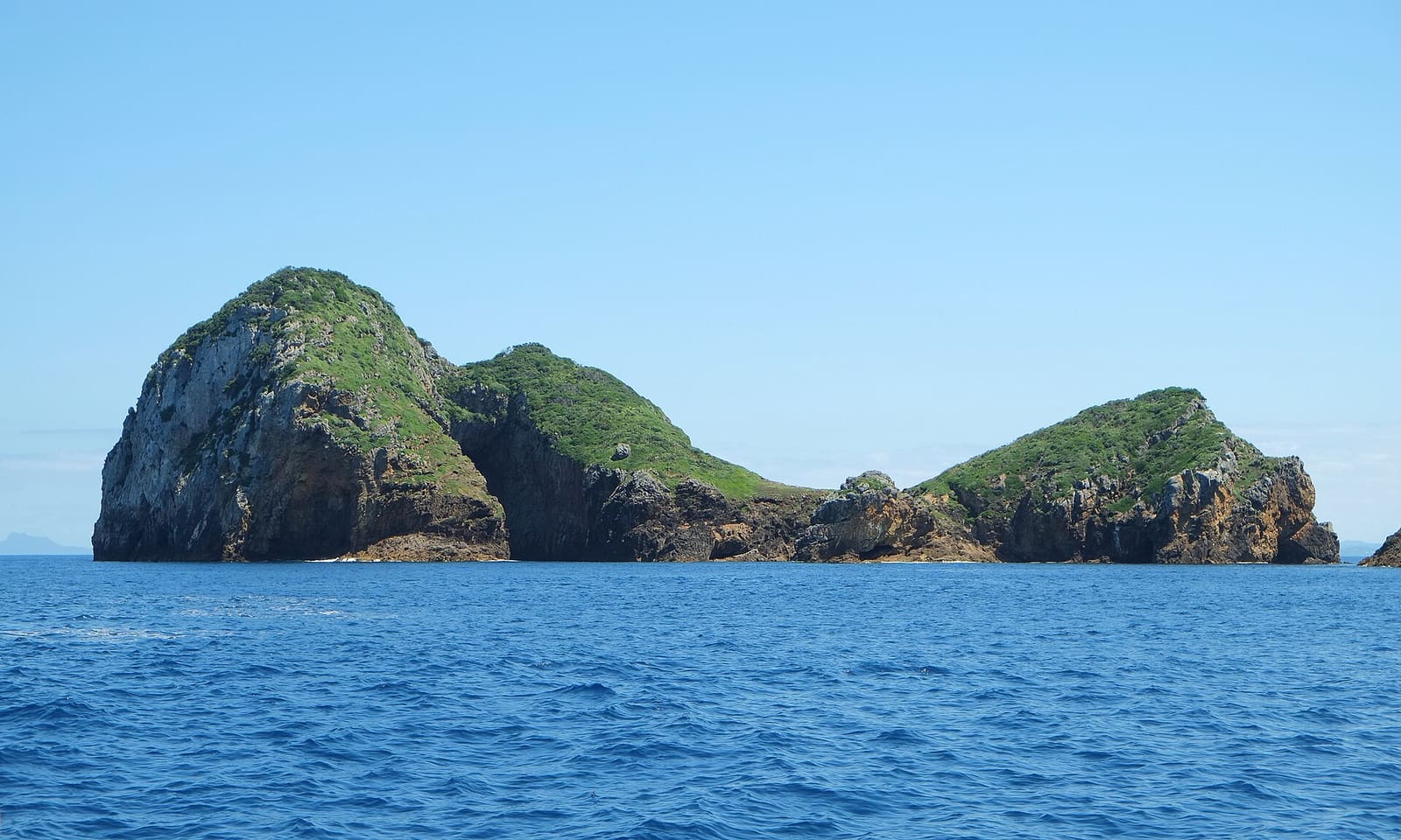
The Poor Knights Islands sit 22 kilometres off the east coast of Northland, New Zealand, halfway between Bream Head and Cape Brett. Boats leave from Tutukaka. Nobody has lived out there since the 1820s.
What makes the place worth the trip is the shape of it. This is the eroded remnant of a rhyolitic volcano, and erosion has left walls, overhangs, tunnels and arches everywhere. Add a warm current arriving from the tropics and you get temperate kelp forest with unexpected visitors mixed in.
The islands and the arches
There are two large islands. Tawhiti Rahi is the northern and larger one at 151.5 hectares, roughly 2.9 km north to south. Aorangi lies to the south at 101 hectares, about 1.7 km long. Both are generally less than a kilometre wide.
Scattered around them are islets and rocks: Aorangaia and Archway Island to the southwest of Aorangi, Motu Kapiti between the main islands, Bird and Kaka Rock, Ngoio Rock to the south. A group to the southwest is called the Pinnacles, and the southernmost of those is the Sugarloaf.
The arches are the signature. Tawhiti Rahi has the Northern Arch, Middle Arch and Maomao Arch, the last of these a popular dive. Aorangaia's east-west arch is more like a long tunnel. Archway Island is cut by two arches, the larger being Cathedral Arch at about 40 metres tall.
Then there is Rikoriko Cave, the largest sea cave by volume in the southern hemisphere. It measures 130 by 80 metres, with a ceiling 35 metres up and water 26 metres deep below. The opening is big enough for small tour boats to motor inside.
What lives there
About 120 fish species are known from the region, and many of them turn up in serious numbers. The islands sit near the edge of the continental shelf, where upwellings of nutrient-rich water keep the filter feeders fed more or less constantly.
The steep walls, overhangs, arches and caves create shaded ground at modest depth, so you see animals that would normally be much further down. Invertebrate life is thickest where the light is too low for seaweed to take over, under the arches and along the walls.
The East Auckland Current runs down from the tropical waters off eastern Australia, carrying larvae of tropical species past Northland. Some settle on these reefs. Many do not survive the winter, but the hardier ones hang on for a few years, looking distinctly out of place among the kelp.
- Large aggregations of stingrays in summer
- Manta rays visiting from tropical waters
- Sunfish, another warm-water drop-in
- Kelp forests feeding and sheltering fish and invertebrates
- Dense filter-feeder growth where the flow is strongest
Above water, the islands are a nature reserve, home to a breeding population of about 200,000 pairs of Buller's shearwaters. The Poor Knights lily flowers here too, and has since become a common garden plant on the mainland. You cannot land without a permit, and permits generally go only to scientific research.
Seasons, water and visibility
Water temperatures are moderate, running between about 14°C in winter and 22°C in summer. Visibility is generally 15 to 40 metres for much of the year, and usually best from late summer through the end of winter, when there is less plankton about. From September to November, plankton blooms can drop it to 5 to 10 metres.
Those blooms are not a flaw in the system. The warming water and longer days in spring set them off, and they feed everything else, triggering spawning and growth across the ecosystem. Trade some visibility for a busier reef.
| Month | Sea temperature (°C) | Wave height (m) |
|---|---|---|
| January | 21 | 1.6 |
| February | 21 | 1.2 |
| March | 21 | 2.0 |
| April | 21 | 2.3 |
| May | 19 | 2.1 |
| June | 18 | 1.7 |
| July | 17 | 1.7 |
| August | 16 | 1.5 |
| September | 16 | 1.5 |
| October | 16 | 1.1 |
| November | 19 | 1.5 |
| December | 20 | 1.6 |
Read that table alongside the visibility notes. The warmest water lands in February and March; the calmest average seas in October, right in the middle of the bloom season. There is no single perfect month, just different trade-offs.
A little history
Māori of the Ngāti Wai and Ngati-Toki grew crops and fished here, and traded with other Māori. In December 1823, while the chief Tatua and his warriors were away on an expedition to the Hauraki Gulf, a raiding party under the Hikutu chief Waikato arrived at night and overwhelmed the islands.
Tatua came back to find nine or ten survivors, among them his five-year-old son Wehiwehi, who had been hidden in a cave. He declared the islands tapu and left for Rawhiti in the Bay of Islands, where he found his wife and daughter, who had escaped their captors. The islands have been uninhabited since.
The name is Cook's. He passed on 25 November 1769 and, the story goes, named them after a bread, milk and egg pudding. Historian John Beaglehole allowed it might instead be a nod to the Poor Knights of Windsor. Nobody is certain.
Planning a trip
Tutukaka is the jumping-off point, with Whangārei 50 kilometres to the southwest of the islands. The marine reserve was established in 1981, New Zealand's second, extending 800 metres out from every island, islet, rock and stack, with full protection over the whole area from 1998.
On kit, the Wikivoyage guide notes that ordinary recreational scuba gear covers most diving here, with a 5 mm wetsuit sufficient in summer. If you want the coordinates and site-by-site detail before you book, that diving guide to the Poor Knights is the place to start.
When you surface from Maomao Arch or come out of Rikoriko into daylight, log it in Scubaspot while it is fresh. Note the visibility you actually got, add your wide-angle shot of Cathedral Arch, and rate the sites so the next diver picking a month knows what to expect. Start at scubaspot.co.