Tung Ping Chau: Hong Kong's Coral Island at the Edge of the Map
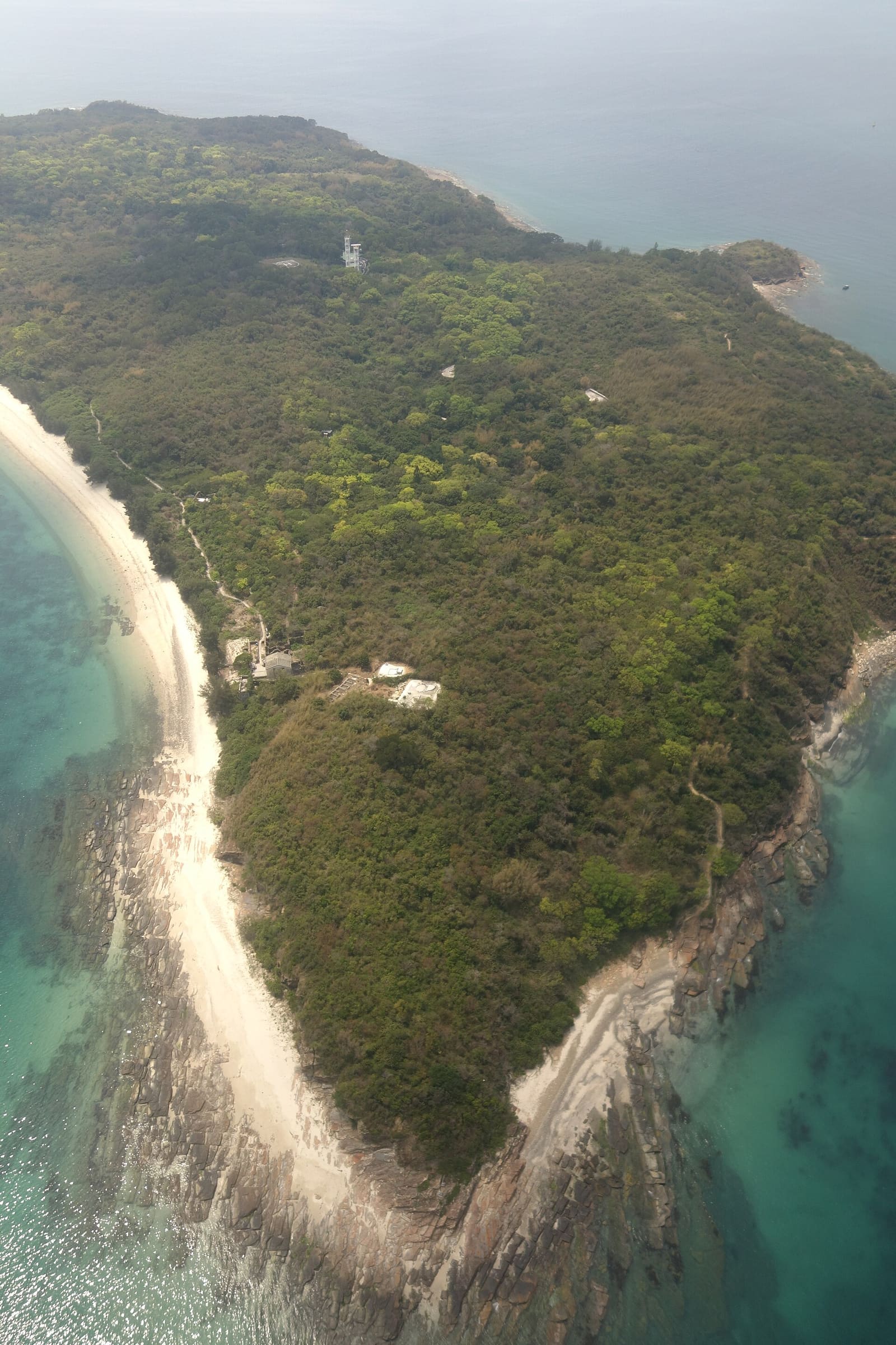
Hong Kong is not the first place most divers think of for coral. Then you get on a ferry at Ma Liu Shui, ride for an hour and forty minutes into Mirs Bay, and step off at an island with more than 60 species of coral along its coastline.
That is Tung Ping Chau. It sits at the far eastern edge of Hong Kong territory, 4 km from mainland China and a long way from everything else.
The whole island is ringed by a marine park, and the rocks above the water are as unusual as the reef below. If you dive in Hong Kong, or you are passing through with a regulator in your bag, this is the trip worth building a weekend around.
An island that emptied out
Ping Chau means flat island. It is kidney-bean shaped, 1.16 square kilometres, with its highest point at just 48 metres.
It was once busy. Three thousand people lived here across ten villages, with over 100 fishing junks working out of the bays. Two primary schools were built in the 1950s, when about 1,500 people still remained.
Then the fish ran out, the Korean War closed trade with the mainland, and the Cultural Revolution finished the job. By the early 1970s only a handful of elderly residents were left. The last permanent resident moved out in 2004.
Sha Tau, the largest village, is a ghost town now with cottages boarded up. Footpaths run through country parkland thick with orchids, wild mint and morning glory. Some former residents come back on weekends, and you can still hear the old Ping Chau dialect in conversations at the restaurants.
The rocks are the other half of the trip
Hong Kong is volcanic country, built from igneous rock thrown up in the Jurassic. Ping Chau is the exception: the only sizeable island in the territory made of sedimentary rock, siltstone and chert laid down in a brackish lake in the early Paleogene.
That geology gives the island its signature features. Below the cliffs lies a wave-cut platform of jagged rock tilted at 30 degrees like a staircase, with rock pools full of sea urchins and crabs.
Then there are the named formations. Lung Lok Shui on the southwestern coast looks like the spine of a dragon sliding into the sea. Kang Lau Shek, the Drum Rocks, are sea stacks of 7 to 8 metres standing on the platform at the southeastern end. Cham Keng Chau in the northwest is a chunk of the island that broke clean away.
It is one of eight Geo-Areas in the Hong Kong UNESCO Global Geopark, and a Site of Special Scientific Interest since 1979.
What is in the water
The Tung Ping Chau Marine Park was designated in 2001, Hong Kong's fourth, covering about 270 hectares of sea around the island.
Along the coastline near the pier there are over 60 different species of coral and 35 species of algae. For a city harbour region, that is a remarkable number in a small area.
The tide pools on the wave-cut platform are worth a look before or after you get wet. Sea urchins, crabs, and the slow business of water working on soft rock.
Water through the year
| Month | Sea temperature (°C) | Wave height (m) |
|---|---|---|
| January | 19 | 0.5 |
| February | 20 | 0.5 |
| March | 21 | 0.5 |
| April | 25 | 0.4 |
| May | 26 | 0.4 |
| June | 27 | 0.4 |
| July | 27 | 0.6 |
| August | 27 | 0.5 |
| September | 29 | 0.7 |
| October | 28 | 0.6 |
| November | 24 | 0.6 |
| December | 21 | 0.6 |
The warm stretch runs long here. From May through October the sea sits between 26 and 29 degrees, peaking in September. Winter drops to around 19 degrees in January. Modelled wave heights stay modest across the year, between 0.4 and 0.7 metres, with the flattest numbers in spring and early summer. Data from Open-Meteo.
Getting there and staying
The ferry leaves from Ma Liu Shui pier, near the Chinese University of Hong Kong, and runs Saturdays, Sundays and public holidays only. Tsui Wah Ferry operates it. The crossing takes 1 hour 40 minutes.
You land at Tung Ping Chau Public Pier at Wong Ye Kok, near the middle of the island. It is the only public pier, improved in 2007.
- A few basic restaurants at Tai Tong, a short walk north of the pier
- Basic dorms at Tai Tong Wan and A Ma Wan
- A campsite plus picnic and barbecue sites run by the Agriculture, Fisheries and Conservation Department
- The Tin Hau Temple, built 1765, and the Tam Tai Sin Temple, built before 1877, both at Sha Tau
- The Old House at Chau Mei, built in the 1940s
Planning a weekend
Because the ferry only runs on weekends and holidays, the island effectively works as an overnight trip. That is no bad thing. 57,000 people visited in 2005, mostly on day trips, so staying over gives you the place at its quietest.
Pair the diving with a walk. Lan Kwo Shui, the long cliff along the southern coast with its sea caves, can be reached on foot from Kang Lau Shek at low tide in calm conditions.
Diving Tung Ping Chau soon? Log the dive in Scubaspot, note how many coral species you actually managed to pick out along the pier coastline, and post a photo of the Drum Rocks from the water. Rate the site so other Hong Kong divers know what the marine park is doing this season. Start at scubaspot.co.