Wakatobi: Four Islands, 150 Islands in All and a National Park the Size of a Country
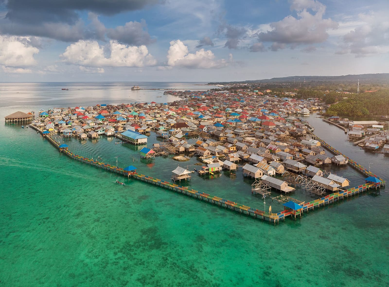
Some dive destinations are a town with a few boats. Wakatobi is 17,554 square kilometres of water with roughly 150 islands scattered across it, and almost all of it sits inside a national park.
That park covers 1.39 million hectares. It was declared in 1996, and the reefs inside it are treated as one of the highest priorities for marine conservation in all of Indonesia.
This is the Coral Triangle, in the biological crossroads known as Wallacea. If reef diving is why you got certified in the first place, this is the part of Indonesia that was built for you.
Four islands, one invented name
Wakatobi is not an old name. It is a contraction of the four largest islands: WAngi-wangi, KAledupa, TOmia and BInongko. Before that the group was known as the Tukang Besi islands, and before Indonesian independence the whole archipelago answered to the Sultanate of Buton.
The regency itself only dates to 18 December 2003. Each of the four main islands is now split into two districts, eight in total, with the capital on Wangi-wangi.
Wangi-wangi holds the regency capital and more than half the population. It is also where the floating Bajau villages sit offshore, built out over the water rather than on it.
Kaledupa and Tomia are the quieter middle of the chain. Hoga Island is named by the park itself as one of its features. Binongko is the far southern end.
The archipelago stretches about 160 kilometres north to south and 120 kilometres east to west, so moving between islands is a real journey rather than a hop. Plan your days around which island you want to be near.
Water, depth and what lives there
The park's waters run deep. The deepest point measured inside its boundaries is 1,044 metres below the surface, which tells you something about how abruptly these reefs drop away from the islands.
The park's own inventory is short and to the point: coral reefs, fishes, other animals. Reef diving here is about the coral itself and the sheer density of fish life that comes with it, rather than a checklist of one headline species.
UNESCO added Wakatobi to the World Network of Biosphere Reserves on 11 July 2012. That designation is about conserving biodiversity and funding research and monitoring, and it is a decent shorthand for how seriously these reefs are taken.
Seasons and sea temperature
Wakatobi has two seasons, wet and dry, like most of Indonesia. The islands sit just south of the Equator and rise between 3 and 350 metres above sea level, so the climate is reliably tropical.
| Month | Sea temperature (°C) | Wave height (m) |
|---|---|---|
| January | 30 | 0.9 |
| February | 30 | 0.8 |
| March | 30 | 0.8 |
| April | 30 | 0.4 |
| May | 29 | 0.8 |
| June | 28 | 1.1 |
| July | 28 | 1.1 |
| August | 27 | 0.9 |
| September | 27 | 0.8 |
| October | 29 | 0.3 |
| November | 30 | 0.5 |
| December | 30 | 0.5 |
Look at how narrow that range is. The coolest month, August, still sits at 27 degrees, and November tops out at 30. Wave height is the more interesting column: June and July run highest at 1.1 metres, while October drops to 0.3 and April to 0.4.
Above the water
There is more here than reef. Wangi-wangi alone has a cluster of hill forts worth a surface interval. Liya Fort, in Liya Togo Village, has four layers of walls and twelve doors, with the Keraton Liya Mosque standing inside them, about 8 kilometres from the regency capital.
Mandati Tonga Fort covers roughly a hectare, its tallest walls about 7 metres on the western and southern sides. Togo Molengo Fort sits at the peak of Mount Kapota Island, a 20-minute traditional boat ride from Wangi-wangi and then ten minutes by motorcycle.
There is also a Dutch colonial lighthouse from 1901 at Waha Village, 8 kilometres from the capital. Kaledupa has the Ollo Fort with its old mosque inside the walls, plus La Donda Fort and the old cemetery at Pale'a. Tomia has Patua Fort and Suo-Suo Fort.
Planning notes
Wakatobi is not crowded. In 2025 the regency recorded 13,378 visitors across the whole year, against a resident population estimated at 119,070.
Those residents are spread across 101 villages on a land area of just 473.62 square kilometres. The great majority are Wakatobi people, with the Bajau making up about eight percent, and it is Bajau communities you will see living over the water off Wangi-wangi.
Pick your island first, then your month. The calmest water in the table lands in October and April; the warmest in November and December.
If you make it out to Hoga or the Tomia reefs, log the dive and drop the depth in while it is fresh, then post a coral shot so the next diver knows what November really looks like down there. Start your Wakatobi trip in Scubaspot and build the island-by-island list with whoever is coming with you.